-
Member pricing
£7.20 -
Non-member pricing
£8.00
Out of stock
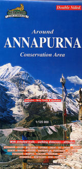
The whole of the Annapurna Circuit prominently highlighted on a map at 1:125,000 from Nepa Maps with alternative variants via the Tilicho Lakes or Naar, treks to the Machhapuchhre and South Annapurna Base Camps, climbing routes to the Chulu Peaks, Pisang Peak and Singu Chuli (Fluted Peak), etc.
Coverage extends from Pohkara to Muktinath and Kagbeni in the north, and in the north-east includes the route to Phu and the trek/climb to Himlung. Contours are at 80m intervals.
The maps was updated in autumn 2015 to show, where possible, sections avoiding local roads.
The index lists settlements, cmaping/base camps, peaks, passes and lakes. Margin ticks give latitude and longitude at 5’ intervals.
Additional information includes a profile of the route and tables showing the route and its variants in stage with altitudes in metres and feet, plus trekking times.
PLEASE NOTE: a similar area is covered by the publishers’ map NA504 at 1:100,000.
Titles in this Nepa Maps series have cartography is based on the country’s topographic survey, with contours usually at 40m or 50m intervals, enhanced by relief shading, colouring and graphics to show various features of the terrain, including glaciers, forested or cultivated areas, etc. Numerous peaks, with additional spot heights, plus names of glaciers and mountain ranges are prominently shown.
The network of rivers, streams and lakes is shown in great detail, with many smaller rivers and lakes named. Overprint highlights main trekking routes and numerous local trails, with symbols indicating various places of interest and tourist facilities. Most maps are indexed and include additional information such as route profiles, glossaries, etc.
All the information is in English and heights are given in metres.
| Weight | 100.00 g |
|---|---|
| ISBN | 9789937649278 |
| Publisher | Nepa Publications |
| Publish Date | 01 December 2010 |
| Binding | Folded Map |
Customer reviews
There are no reviews yet.