-
Member pricing
£5.40 -
Non-member pricing
£6.00
Out of stock
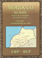
Jbel Toubkal and the surrounding area on a hiking map at 1:50,000, with on the reverse a detailed street plan of central Marrakesh, including its Medina, printed on light, waterproof and treat-resistant synthetic paper.
On one side is a detailed topographic map at 1:50,000 centred on the village of Imelil, about 8km north of Toubkal, covering an area of 32kms east/west by 22kms north/south. Topographic information includes contours at 20m intervals, hill-shading, woodland and scrub areas, springs, creeks, rivers and dry riverbeds. The map shows local roads, tracks and footpaths. Funicular railways and ski-lifts are also marked. Symbols indicate locations of campsites and refuges, ski-stations, and religious buildings. The map has a 1km UTM grid and margin ticks at 5’ intervals.
On the reverse is a clear plan of central Marrakech at approximately 1:8,700. It covers the Medina district and extends westwards to the main railway terminus. Colours highlight main sites of interest, public buildings, shopping areas/markets and pedestrian zones. One-way streets are marked and symbols show a range of useful features e.g. selected, hotels, taxi ranks, car parks, information offices, petrol stations, public water fountains, places of worship, etc.
| Weight | 50.00 g |
|---|---|
| ISBN | 9781904207474 |
| Publisher | Cordee |
| Publish Date | 04 August 2008 |
| Page size | 115mm x 240mm |
| Binding | Folded Map |


Customer reviews
There are no reviews yet.